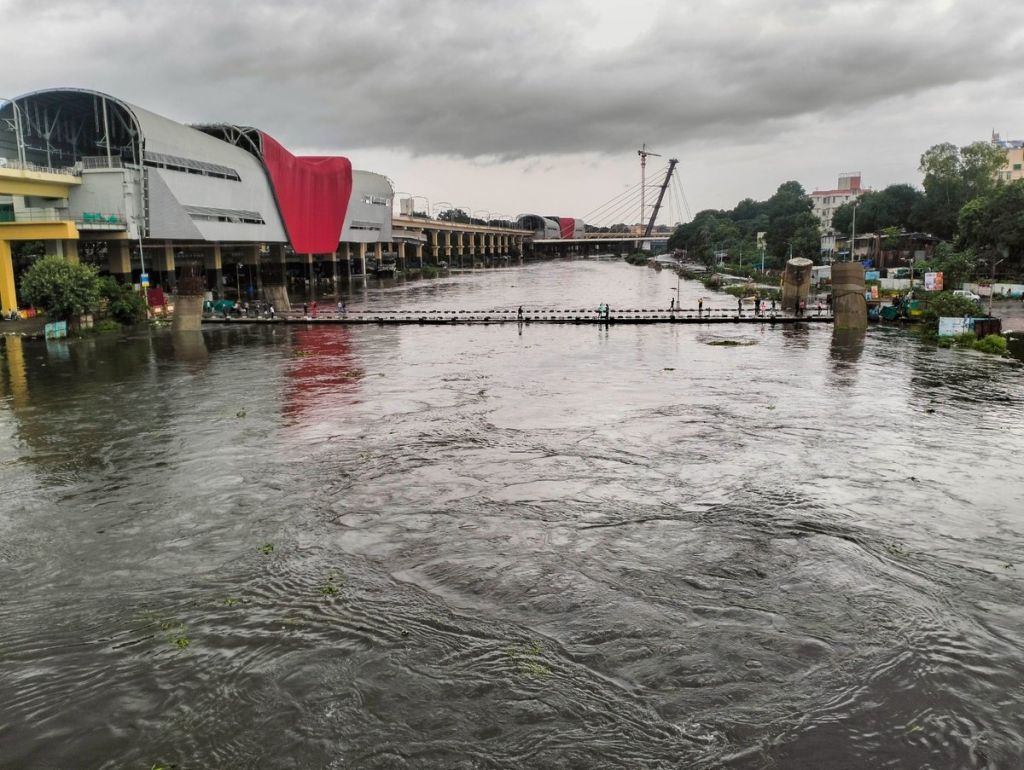
In July this year, Pune witnessed floods in the low-lying areas. The Indian Army was deployed in Ekta Nagar at Sinhgad Road for the rescue operation. Following the incident a committee was formed by the Municipal Commissioner to probe the actual reasons behind the floods caused by the release of water from Khadakwasla Dam after incessant rains lashed the city.
A four-member committee comprising engineers Sahebrao Dandge, Dinkar Gojari, Bipin Shinde and Sunanda Jagtap submitted a critical flood management report in early September. However, it was made public only after civic activist Vivek Velankar obtained it through an RTI request.
The report indirectly holds the Pune Municipal Corporation (PMC), the Irrigation Department and the Collector’s Office responsible for failing to prevent the disaster. The report reveals encroachment, debris dumping, development in vulnerable zones and reduced natural drainage among the key reasons behind the floods.
Velankar said, “This committee submitted its report to the Commissioner on August 30. However, citing the Model Code of Conduct, the Commissioner avoided providing me with a copy of the report. Even after the election officials instructed the Commissioner to share the report, it was not given to me. Finally, after the elections, the Commissioner’s Office handed me the report a couple of days ago. Upon reading the report, it became evident that it had no connection whatsoever with the Model Code of Conduct or the elections. It remains a mystery why the Commissioner felt the need to withhold it?”
The report highlighted that the river’s carrying capacity from Khadakwasla Dam to Sangam Bridge has been reduced due to illegal constructions, garbage, and debris dumping. According to the committee, the Blue Line Capacity of the river is 60,000 cusecs while the Red Line Capacity is 1,00,000 cusecs. Previously, releasing 60,000 cusecs caused minimal waterlogging. However, due to obstructions, even a discharge of 35,000-40,000 cusecs now leads to major flooding.
Key issues identified in the report:
Encroachments and dumping
- Unauthorised constructions and waste dumping have narrowed river cross-sections, obstructing water flow.
- Development projects such as roads, bridges and metro rail lines exacerbate these obstructions.
Reduced natural drainage
- Encroachments and agricultural activities disrupt natural drainage, causing floodwater stagnation in low-lying areas.
Obstructive infrastructure
- Underpasses, small bridges and embankments within riverbeds act as bottlenecks during floods.
Lack of accurate flood mapping
- Flood-prone areas lack detailed mapping, hindering disaster preparedness and response.
Recommendations by the expert committee:
Restoration of riverbeds
- Remove encroachments and rehabilitate affected residents.
- Restore natural drainage systems and widen waterways to improve flow.
Waste management
- Enforce strict measures to prevent solid waste and construction debris from entering rivers.
Flood mitigation infrastructure
- Raise riverbanks in flood-prone areas.
- Develop retention ponds and green buffers to absorb flood impacts.
Policy and zoning
- Overlay flood lines (blue and red) on city development plans to prohibit new constructions in vulnerable areas.
Technology integration
- Instal automatic rain gauges and establish flood monitoring centres along major rivers.
- Develop a Decision Support System (DSS) for real-time flood management.
Flood mapping and vulnerability assessment
- Create digital elevation and inundation maps for flood-prone zones.
- Determine return period flood levels (e.g., 3, 10, 15, 20 years) for informed planning and evacuation.