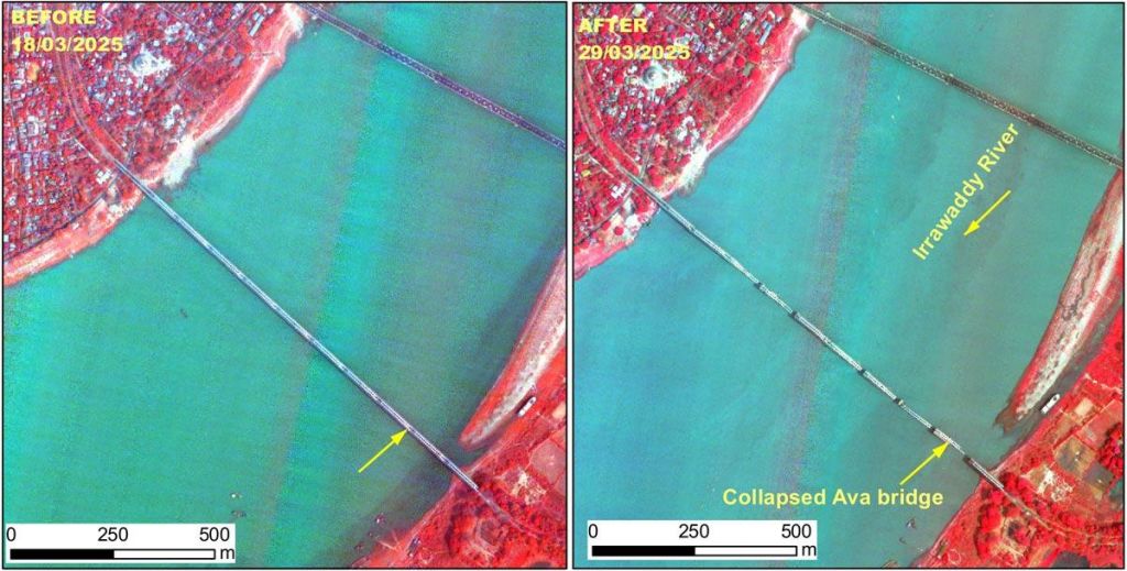
ISRO's Cartosat-3 satellite captured images of the damage caused by the 7.7 magnitude earthquake in Myanmar on March 28. The images show significant damage in Mandalay and Sagaing cities, including the complete collapse of the historic Ava (InnWa) Bridge near Inn Wa City. The earthquake also caused cracks and ground ruptures in the flood plains of the Irrawaddy River.