Cyclone Dana, which is still hovering over Bay of Bengal is inching closer to the country's eastern coast. The states of Odisha and West Bengal are expected to face the worst of the cyclone's fury. Both states are bracing for impact and governments there have swung into action to ensure minimum damage. India Meteorological Department (IMD) has categorised Dana as 'severe cyclonic storm'. It is expected to make landfall on Thursday (October 24) night.
IMD on Cyclone Dana:
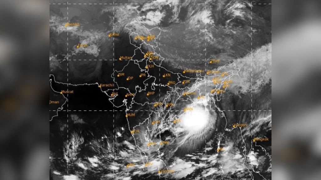
In a special bulletin released by IMD just before dawn on Thursday (October 24), the IMD has said that Cyclone Dana is approaching the coast at a speed of 15 kmph.
When the weather bulletin was issued, the cyclone was 280 kilometres from Paradip (Odisha) and 370 km south-southeast of Sagar Island (West Bengal).
The IMD has predicted that the cyclone will move in the Northwestern direction, that is, towards the Indian coast.
The landfall is likely to take place on the midnight of October 24th and the process will continue till the morning of October 25. The cyclone is expected to make landfall between Puri and Sagar Islands and close to Bhitarkanika and Dhamara (Odisha). It has been predicted that Cyclone Dana will cause winds gusting upto 120 kmph.
The cyclone will gradually lose power and reduce in intensity by evening on October 25.
Cyclone Dana Rain Alert:
Almost the entirety of Odisha is likely to witness heavy to very heavy rainfall on Thursday and Friday. The state of West Begal is expected to witness heavy rains. The sea conditions are expected to be rough on October 24 and 25.
The IMD has advised 'total suspension of fishing operations' till October 25.